[ad_1]
Some weather phenomena continue to fascinate humanity. Some could be a mystery when seen by the naked eye, but the characteristics of being odd still mesmerize the public.
Here are some of the unusual weather phenomena that the public might be interested to know about:
Mammatus Clouds
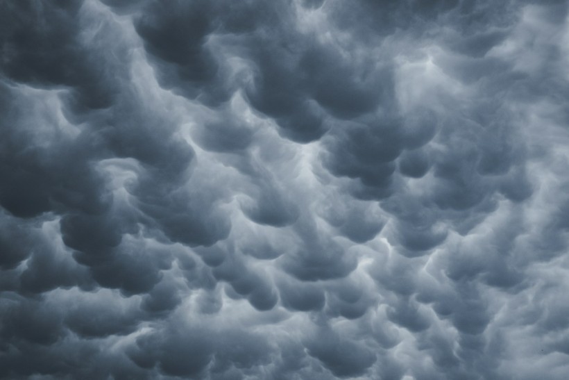
Mammatus clouds are some of the most unusual and distinctive clouds formations with a series of bulges or pouches emerging from the base of a cloud, according to the UK MET Office.
The shape of mammatus formations can vary widely; and it goes from the classic protruding shape to a more elongated tube hanging from the cloud above.
These clouds are usually formed in association with large cumulonimbus clouds. Typically, turbulence within the cumulonimbus cloud will cause mammatus to form, especially on the underside of the projecting anvil as it rapidly descends to lower levels.
This reverses the usual cloud-forming process of upward growth, making for an uneven cloud base.
Mammatus clouds generally form in the most unstable cumulonimbus, meaning that there is also a chance of hail, heavy rain and lightning in the vicinity, and if the air is cold enough during winter they can even produce snow.
However, there are instances that some mammatus may form on other cloud types which produce no rain, though this is far less common.
Arcus Clouds

On the other hand, experts defined arcus clouds as spectacular low-level, long and thin clouds associated with powerful thunderstorms.
They are sometimes seen beneath cumulonimbus clouds. Shelf clouds are attached to the storm cloud, whereas roll clouds are a horizontal column separated from the storm cloud.
This type of cloud usually forms when a cold downdraft from a cumulonimbus cloud reaches the ground. The cold air will then spread rapidly along the ground, pushing existing warm moist air upwards.
As this air rises, water vapor condenses into the patterns associated with the arcus clouds.
Sundogs
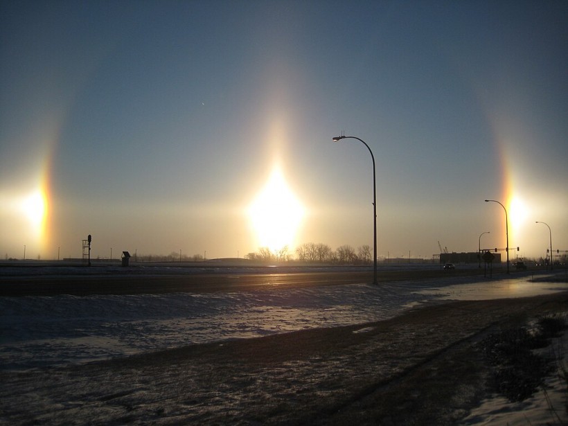
The National Weather Service defined sundog as a concentrated patch of sunlight that is occasionally seen to the right or the left of the sun or even on both sides of our star in the sky simultaneously.
Usually, they appear as a pair of patches of light with subtle colors which manifest at the same altitude over the horizon as the sun.
They can also appear in a variety of forms, sometimes as colorful spots, or other times, so intense and bright they appear to be two additional suns in the sky.
Sundogs are formed when light passes through hexagonal plate crystals of ice, suspended in cirrus or cirrostratus clouds located at altitudes of around 20,000 feet (6,000 meters) and higher, up to 40,000 feet (12,000 meters).
Ball Lightning
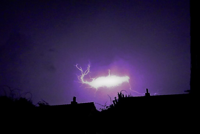
Scientists said that this bizarre phenomenon usually appears during thunderstorms as a floating sphere that can range in color from blue to orange to yellow, disappearing within a few seconds.
Also known as globe lightning, this phenomenon could sometimes be accompanied by a hissing sound and an acrid odor.
Researchers from Lanzhou, China’s Northwest Normal University had recorded a ball lightning event while they were conducting a study on a 2012 thunderstorm using video cameras and spectrometers.
The ball appeared just after a lightning strike and traveled horizontally for about 10 meters (33 feet).
Read Also: Trace Gases Can Be Formed From Aerosol Particles That Seed Clouds
Brinicles
Research has shown that the name brinicle is a combination of brine and icicle, and they grow downwards from sheet ice.
The freezing process forces out salt, creating intensely cold, salty water that does not freeze because of the salt concentration.
This is heavier than normal sea water; therefore, it tends to sink. This is characterized as a finger of ice slowly descending from above, freezing everything it touches and leaving a trail of frozen corpses.
It is often deemed as an unusual underwater phenomenon, sometimes found in the Antarctic Ocean.
Frost Flowers
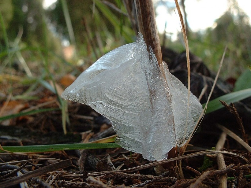
Frost flowers are thin layers of ice that are extruded through slits from the stems of white or yellow wingstem plants, among others, the National Weather Service described.
Their formation requires freezing air temperature, soil that is moist or wet but not frozen, and a plant’s stem that has not been previously frozen.
Not all individuals produce frost flowers on the first day of good conditions.
Virga Clouds
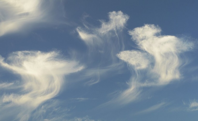
Virga clouds re trails of precipitation that fall from the underside of a cloud but evaporate or sublime before it can reach the earth’s surface.
This happens when falling rain or ice passes through an area of dry or warm air.
Virga clouds are often associated with precipitation that does not reach the ground, often happening in isolated locations on sometimes, the finest of days.
However, in some instances, these clouds can lead to the development of microbursts, which pose a dangerous threat to planes and aircraft.
Related Article: Ocean Gases From Phytoplankton Aid in the Formation of Dense Clouds That Reflect Sunlight in Antarctica
© 2024 NatureWorldNews.com All rights reserved. Do not reproduce without permission.
[ad_2]


